Have you ever tried to import bathymetric map or any other map in Petrel ?
Most probably, the map was represented as a flat surface on top of your study area (i.e. Zero level) or maybe at a wrong level. The main problem comes from the time-depth conversion, as bathymetry is generally in meters whereas a seismic software is in seconds (time domain).
The workflow is as follows:
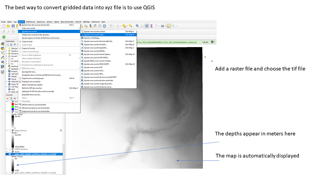
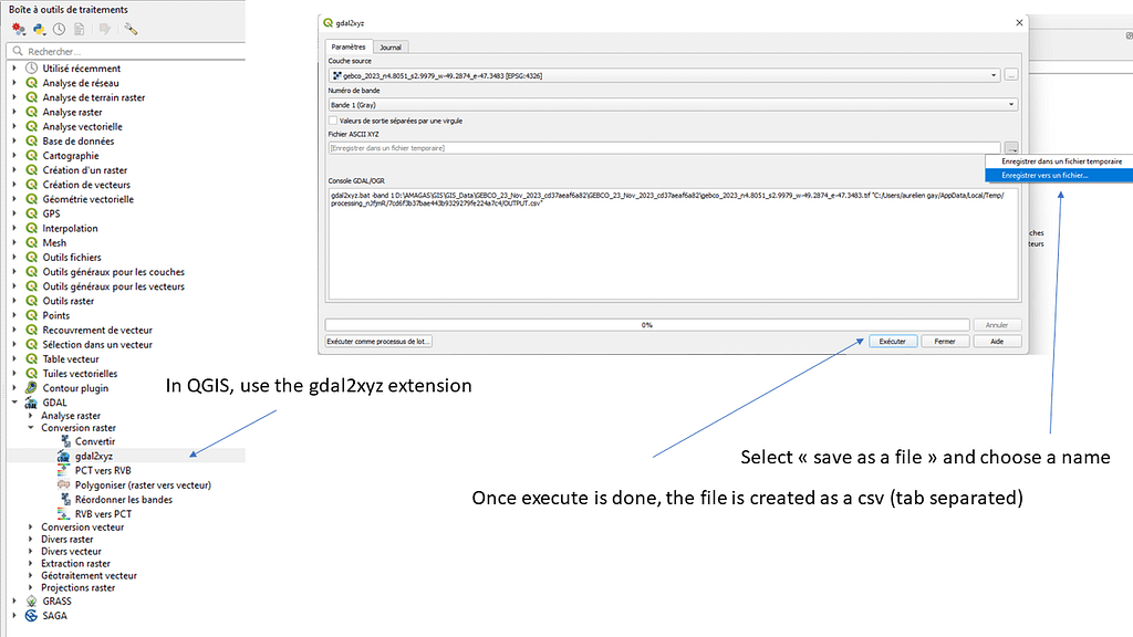
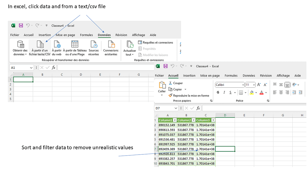
1) Get a xyz file representing bathymetry
2) Convert this file using the velocity in water, so the bathymetry is now in seconds
3) Import 4) Make surface
However, it’s not as simple !
1) Get a xyz file
Here is an example using GEBCO data: https://download.gebco.net
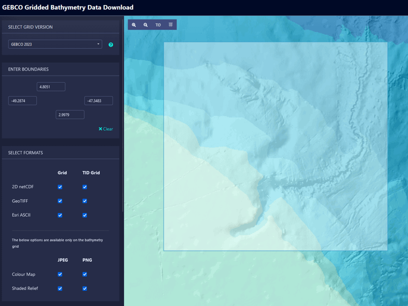
Select your area of interest and download all available data. Unzip folder. At this stage all data are gridded.
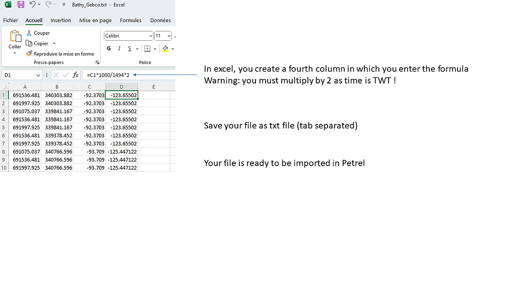
2) Convert Depth in Time
In seismic interpretation we usually interpret in time. So, it means that all data must be converted in time domain prior to any import process. It is very difficult to convert data in time once they have been imported in depth… So, please think different, think in time !

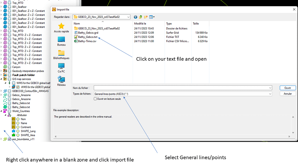
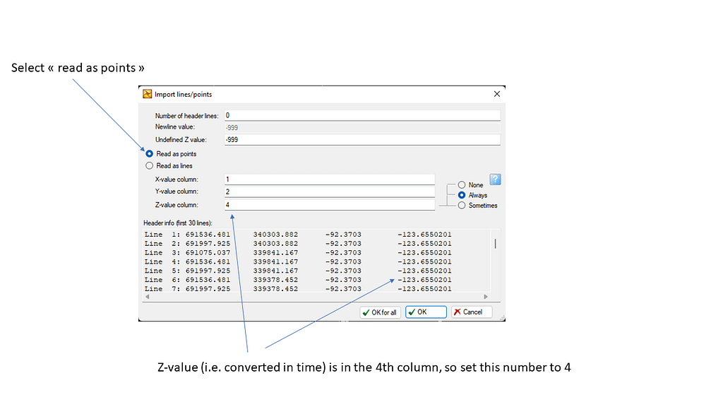
3) Importing the newly created file (in time)

4) Make a surface = interpolation


Please remember that bathymetric data are obtained from a multibeam device that has different acquisition parameters than a seismic device (source, wavelength etc…). It means that you may observe shifts between the bathymetric map and a seafloor horizon obtained by propagation on seismic profiles.
ENJOY !
Retour de ping : Managing coordinates before importing a map – AurelienG
Retour de ping : How to manipulate large sheet files: SURFER ! – AurelienG