Coordinates are often embedded in the sgy file. However, the header doesn’t contain any details about the coordinate system. By chance, you know where the seismic profile is, or you have a map displaying GPS coordinates. Let’s use QGIS !
First of all, you must open the sgy file using either SeismicExplore (installed with kingdom) or SeiSee (freeware). X and Y coordinates are usuellay located in bytes 73/81 and 77/85 respectively.
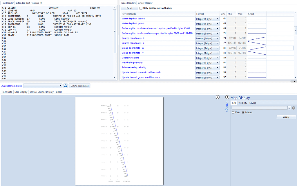
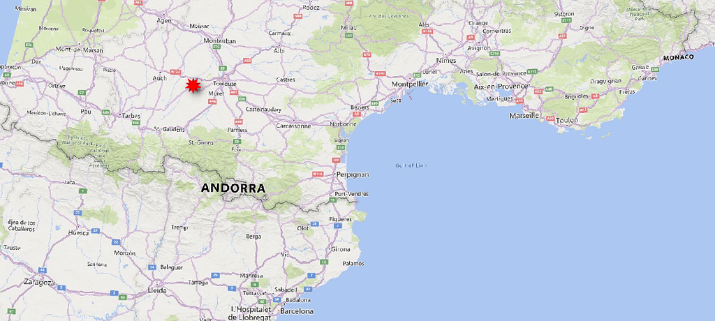
In this example, X and Y coordinates are unknown, but I know that this profile is located in the gulf of Aigue-Morte (Mediterranean Sea). Copy XY coordinates and paste in excel. Using the map display, you know that the X:339989,Y:4821878 point is located in the top left corner.
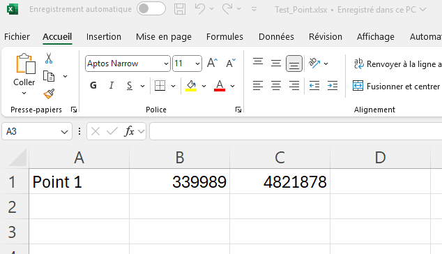
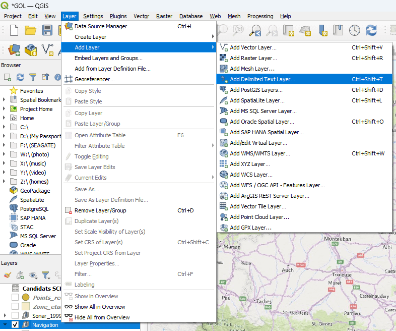
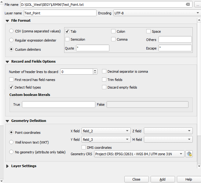
Save the file as « test_something » and resave it as txt (tab delimited). Import this txt file in QGIS
By default, my QGIS project is in UTM, depending on the zone. Here it is UTM 31 N corresponding to EPSG 32631 (the same as my kingdom project). It’s tab delimited and X and Y fields correspond to field 2 and field 3 (columns 2 and 3 in the text file).
Once imported, the txt file displays one point in the middle of Pyrenees !
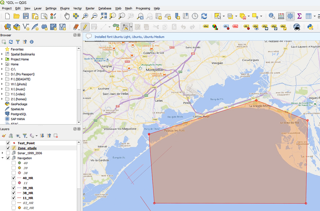
There is something wrong:the CRS (Coordinate Reference System) is not EPSG 32631 ! As I know that the point should be near Montpellier, I can create a small polygon surrounding the area where the point is supposed to be.
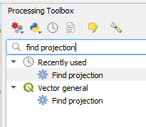
In the toolbox you can type « find projection »
Choose the text file as input layer, and the polygon as target area (or create a polygon from there).
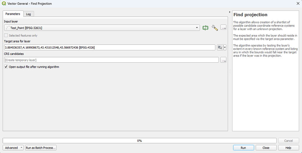
So, using the coordinates, the tool will propose possible candidates, meaning a list of CRS containing the XY values in the area 🙂
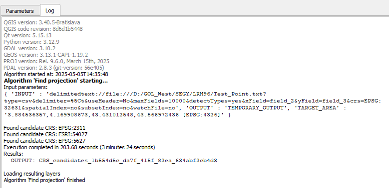
I’m lucky: only 3 candidates. Let’s explore them. The first one is EPSG 2311. Type it in google:
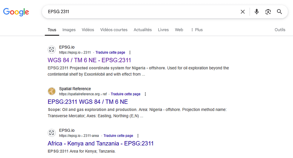
This is far from the study area, even if the coordinates match this reference system. Let’s try ESRI 54027
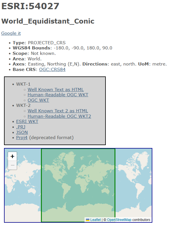
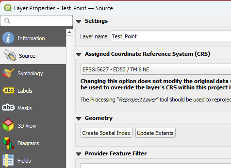
It could be this one. However, sgy files are generally recorded using local geodetic systems. Let’s try EPSG 5627
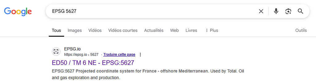
This one looks good !!!
You can change the reference system in properties
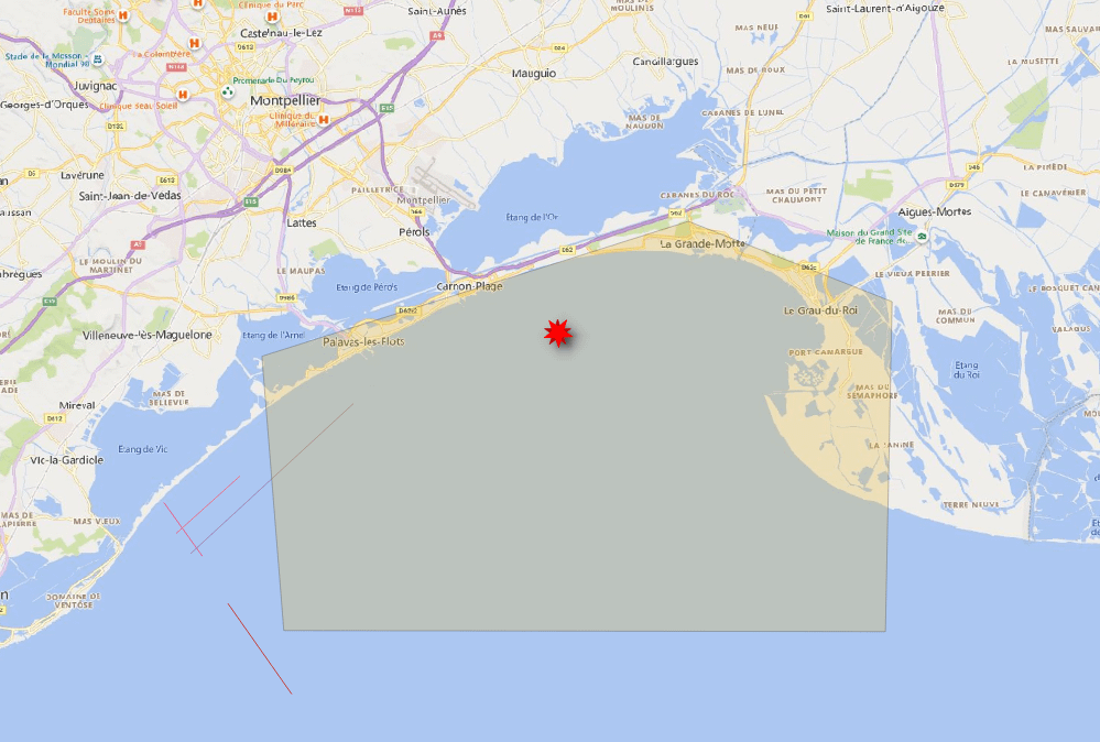
And now, the point is located within the area although the project is set to UTM 31N:
ENJOY !