This was my first research report for my Master’s degree in 1999 (DEA: Diplôme d’Etudes Approfondies), almost 25 years ago. This was the first time a numerical model was publicly presented to the Master’s jury.
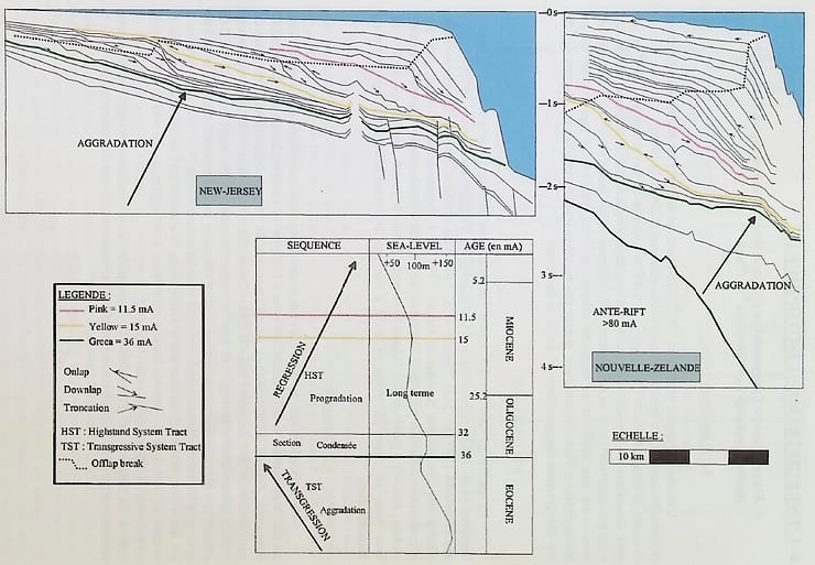
Based on seismic stratigraphy, we were able to describe a major change in the architecture of basins at Oligocene. This could be explained by a drastic change in climatic conditions on Earth, from a greenhouse period (no polar caps) to a icehouse period (fast alternating glaciations and interglacial periods). These new conditions may have increased erosion and weathering on lands and huge amounts of clastic materials were transported to basins.
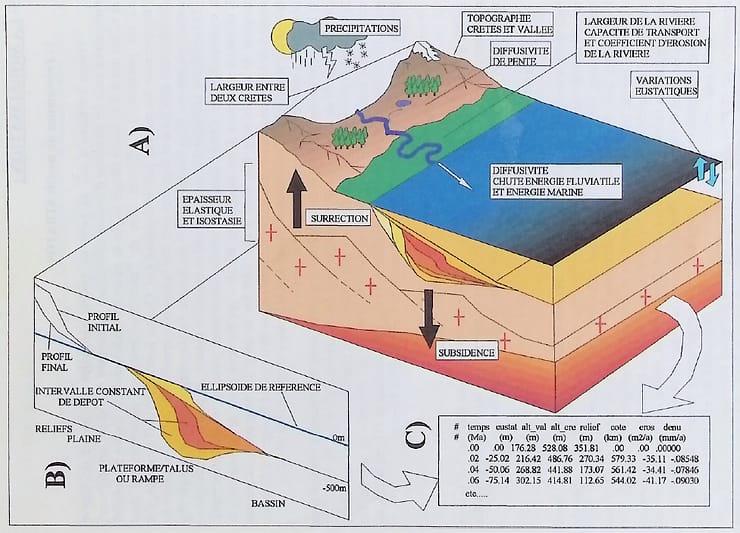
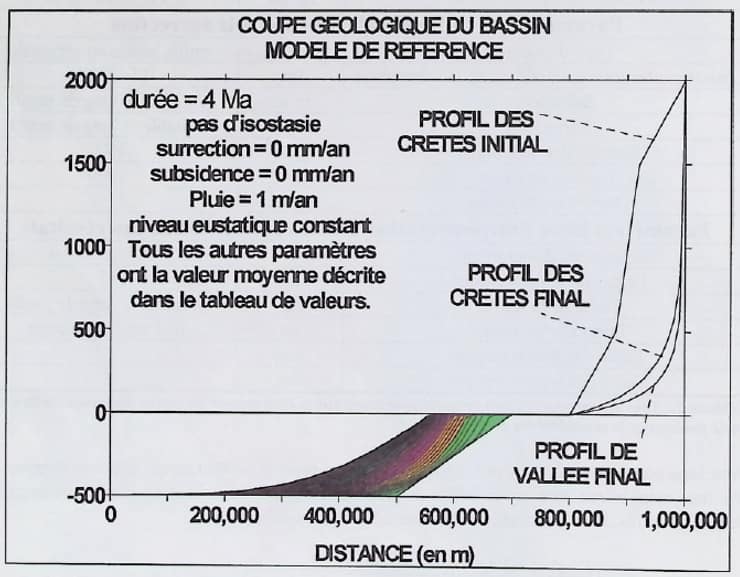
A new numerical model (STRATOS – developed by F. Lucazeau at the University of Montpellier) was used to test a set of parameters such as topography, rainfall, the diffusivity of sediments along slopes etc… It appeared that the increase in erosion is not controlled by a single parameter. The fast alternation (i.e. 100 ka) between glacial and interglacial periods is responsible for a constant disequilibrium of the base level.
In the light of the actual climate change, I could modify now my conclusions, stating that the fast sea level drop will probably lead to an increase in available sediments on slopes. This will probably have consequences on general instabilities leading to higher risks.