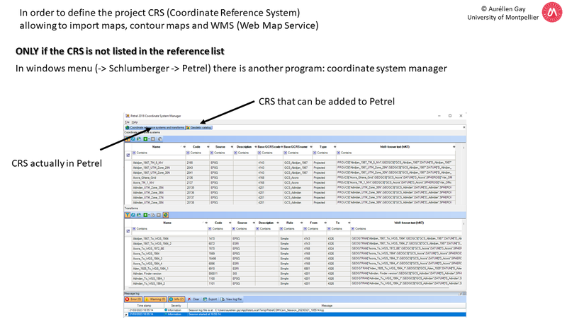
Petrel has a lot of CRS (Coordinate Reference System) embedded in the main program. However, if your CRS is not listed, you must use a companion program called “Coordinate System Manager”. This program is in the windows menu -> Schlumberger – Petrel
Then the procedure is as follows:
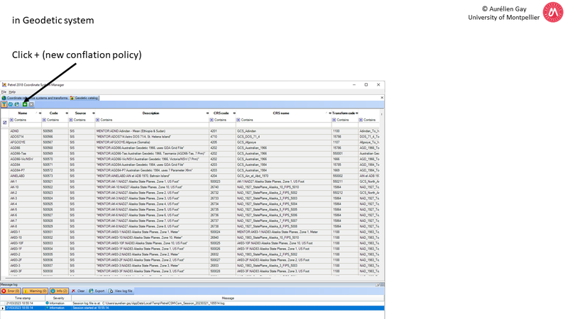
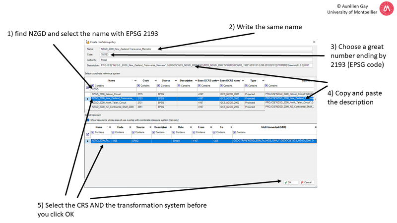
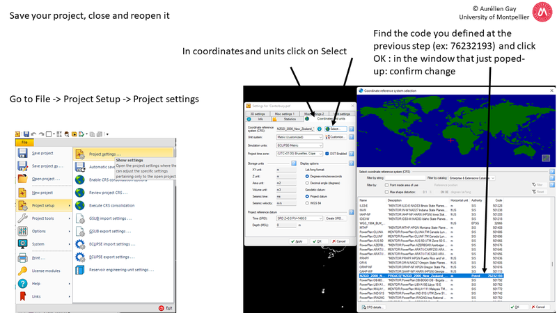
1) Create your own CRS – Close and reopen Petrel to update the list – Define the new CRS
2) Start to import maps and WMS
So, follow the guide here:
STEP 1: create your own CRS
Now your CRS is defined in Petrel, you can import maps !
STEP 2: Start to import maps and WMS
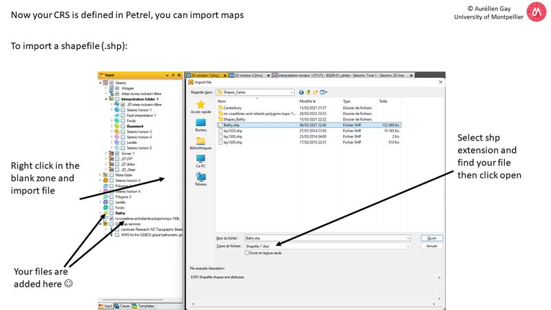
We will start to import shapefiles.
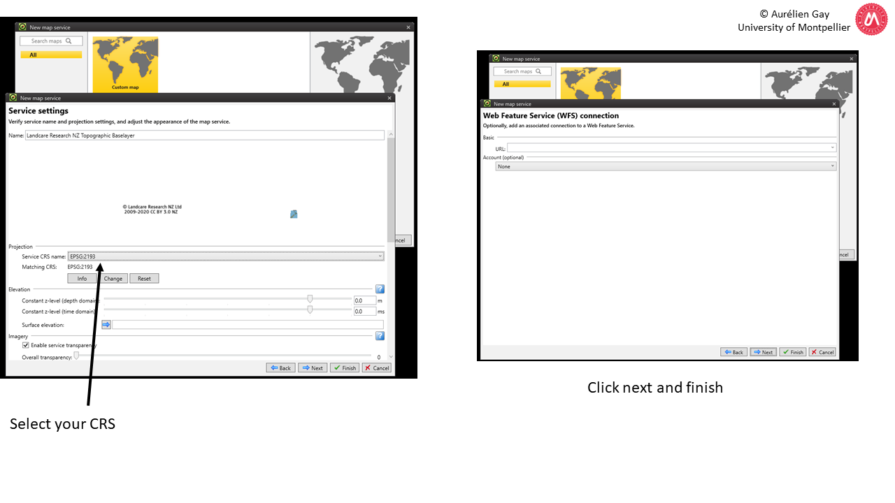
You can add WMS = Web Map Services:
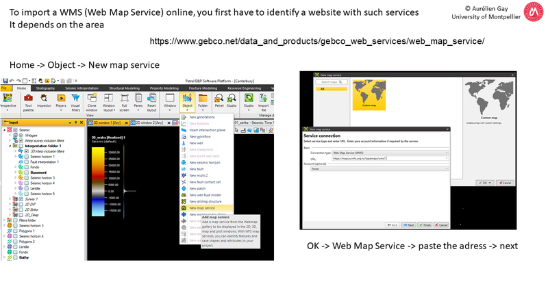
Gebco is very common in marine geosciences. The address changes regularly, so just type “GEBCO WMS link” in google. This is the first result.
On March 2024, the link is: https://wms.gebco.net/mapserv?
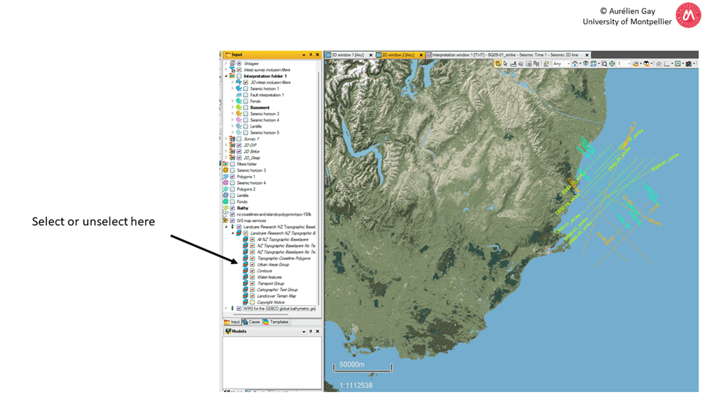
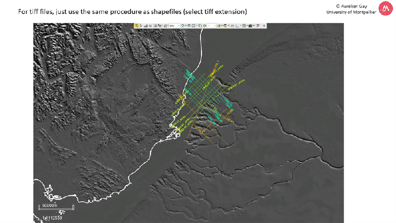
ENJOY !