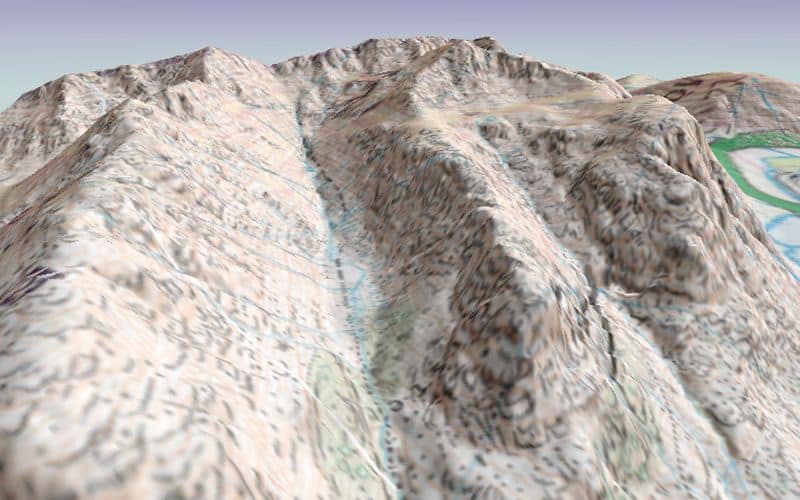
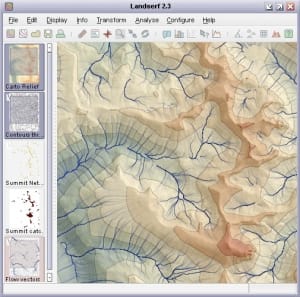
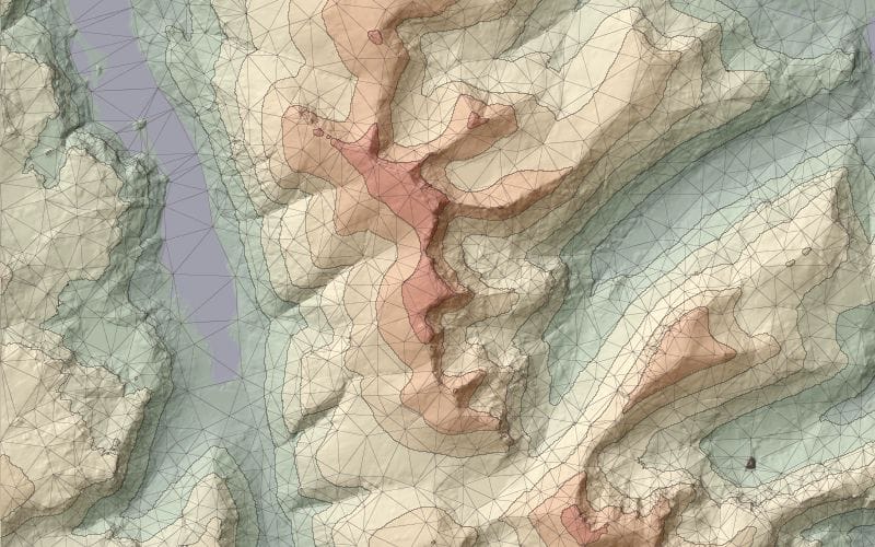
LandSerf is a freely available application for the visualisation and analysis of surfaces. Applications include visualisation of landscapes; geomorphological analysis; gaming; GIS file conversion; map output; archaeological mapping and analysis; surface modelling and many others. It runs on any platform that supports Java (Windows, MacOSX, Unix, Linux etc.)
https://www.staff.city.ac.uk/~jwo/landserf/index.html
Features:
- Handles multiple surface models – raster digital elevation models (DEMs), vector Triangulated Irregular Networks (TINs), contours and metric surface networks (MSNs).
- Interactive 3D viewing and ‘flythrough’ of surfaces on platforms that support OpenGL.
- A range of powerful and interactive visualisation techniques including lighting/shade models, multiple image blending and dynamic graphical query.
- Fully controllable either via its attractive graphical user interface, or via scripting.
- Raster and vector transformation including image rectification and map projection.
- Multi-scale surface processing based on quadratic regression.
- Fractal and polynomial surface generation for modelling and simulation.
- Multi-scale parameter and feature extraction (slope, aspect, curvature etc.).
- Import and export of common raster and vector formats.
- Import and export from and to Garmin GPS receivers.
Download:
LandSerf is available for Windows, Linux and MacOSX. To download right click (Ctrl-click on Mac) on the relevant link below and ‘Save link as…’ somewhere on your computer.
- landserf230WindowsInstall.jar.zip (9.8 Mbytes)
- landserf230LinuxInstall.jar (9.9 Mbytes)
- landserf230MacOSXInstall.jar (9.8 Mbytes)
Documentation:
- The LandSerf Manual (pdf) – All the LandSerf documentation in a single searchable book.
- User’s Guide – Description of all LandSerf’s features with examples of their use.
- Tutorial – Step by step tutorial on how to use LandSerf.
- ‘How to’ guides – Instructions on undertaking specific tasks with LandSerf, such as programming, scripting and importing data.
- Theory – Detail on some of the theoretical techniques implemented by LandSerf.
- Changes – Changes since the previously released version of LandSerf.
- Third party software – Details of third party software and code and used by LandSerf.
ENJOY !